(thomashornerwx.substack.com)
Two-phase system lined up for Colorado that’s a little deeper than expected, moving timings forward a bit and eliminating some of the bust potential for the Front Range.
Despite the extensive length of this article, for most people this will be a middling to decent event (compared to how much you normally get during a “good” storm), but there are some high-end scenarios in play (including for the Denver metro area) and some particularly favored spots.
This article mostly focuses on the “how/why” and doesn’t get too much into the timings. There are some total snowfall probability graphs included within if you want to a more specific idea of how much snow I’m talking about.
Hey, anyone remember that white stuff that falls from the air in the winter?

Okay, perhaps this is more realistic:
Anyways, I don’t get paid to meme. Actually, I don’t get paid at all, thus disproving the myth that meteorologists are paid to be wrong 50% of the time. I do that for free.
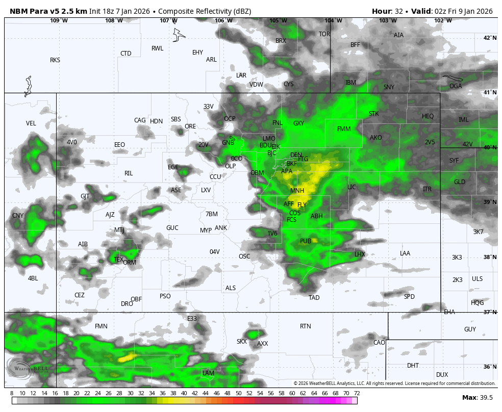
The first flakes are falling in western Colorado, with snow spreading throughout the state tonight. For most areas, including the Front Range and I-25 corridor, heaviest snowfall rates will be tomorrow morning, with another wave of snow Thursday night into Friday.
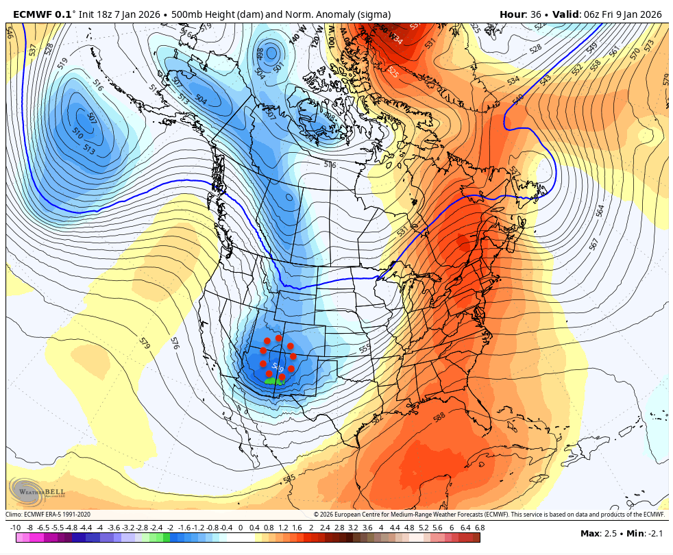
As discussed in the previous article, this is a double-barreled system, with an initial closed low tracking across the desert southwest that will prime conditions for the main/parent trough following quickly behind it tomorrow. You can see that initial low on satellite right now, currently entering the Sonoran Desert:
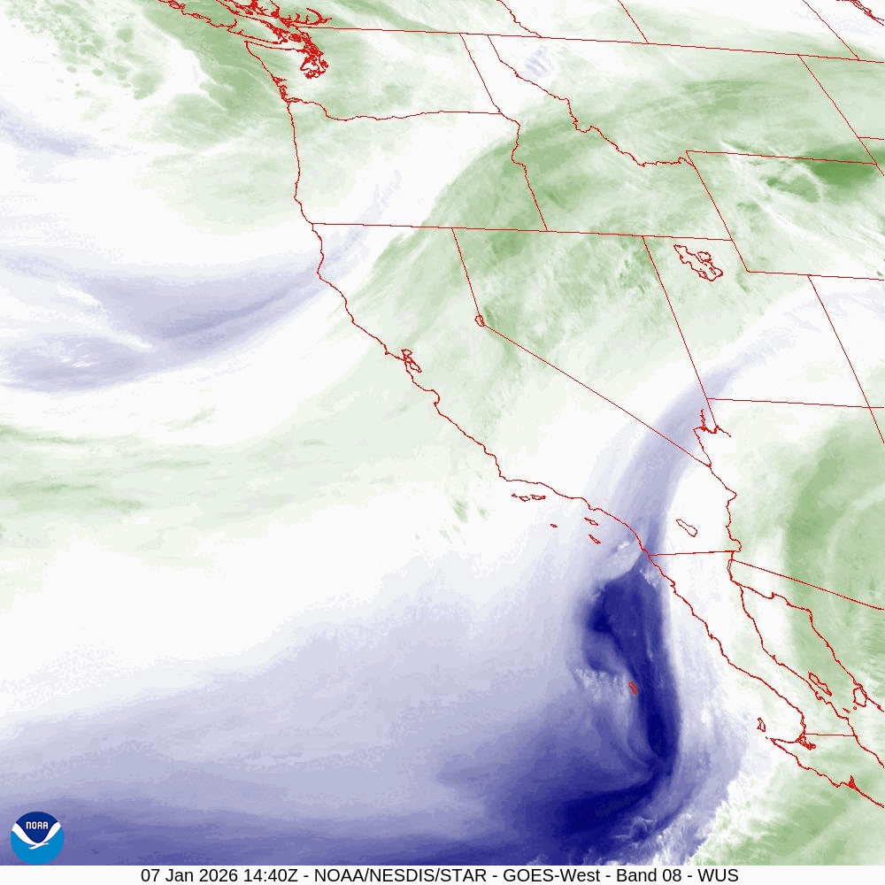
You can also see the primary trough coming ashore in the Pacific Northwest. Good stuff. Here’s a diagram of what I’m talking about:
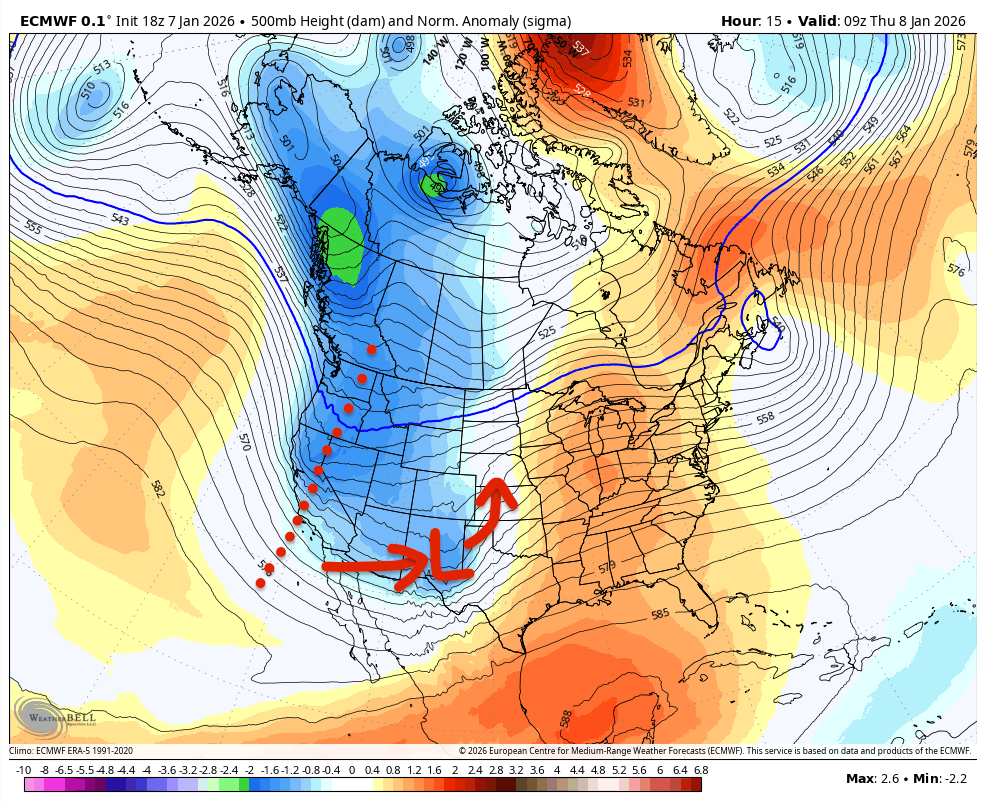
Not very helpful, is it?
The tilt of the trough will rotate, with some negative tilt by the time it reaches Arizona, helping drive cyclogenesis. That should spin up a Four Corners low:
I hope you’re taking notes, as there will be a quiz at the end of this article.
So with limited time to adjust expectations, let’s talk about what’s changed since my previous forecast. It’s pretty much all good news: there’s been a significant reduction of uncertainty — at least insofar as the probability of a low-end event — thanks to ground-based observations confirming some expectations about the upcoming system.
The initial low and its parent trough look a bit deeper. This pushes timing forwards a bit. It’s also more likely that the initial low gets dragged closer into the trough as it orbits northwards.
The initial low is now more likely to provide some enhanced dynamics for the Front Range foothills, I-25 corridor, and high plains tomorrow. In the previous article, I discussed a scenario where it’s far enough northeast to actually help induce downsloping winds which would reduce if not decimate snow potential for the I-25 corridor and west into the lower foothills. That scenario has all but disappeared.
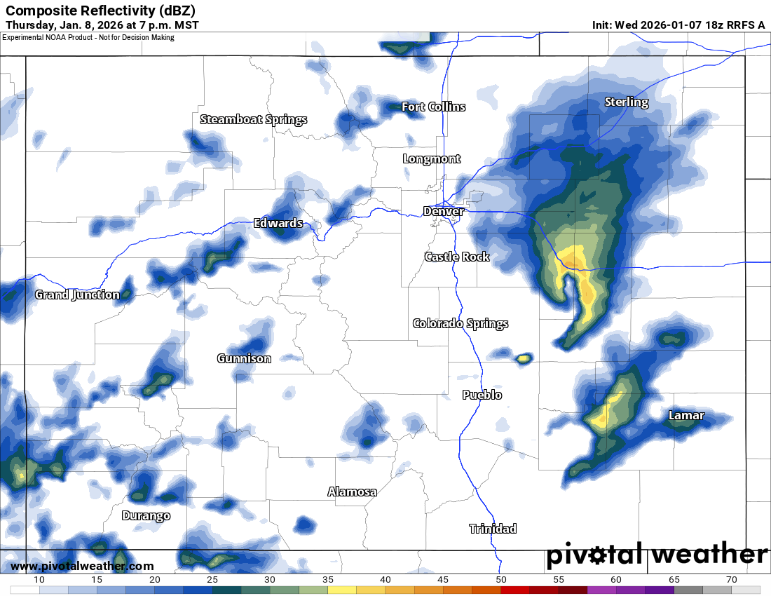
Conversely, many of the higher-end scenarios are becoming more prevalent in guidance, particularly in the CAMs, which were very stingy yesterday. One can’t help but be amused that the RRFS swung all the way from this…
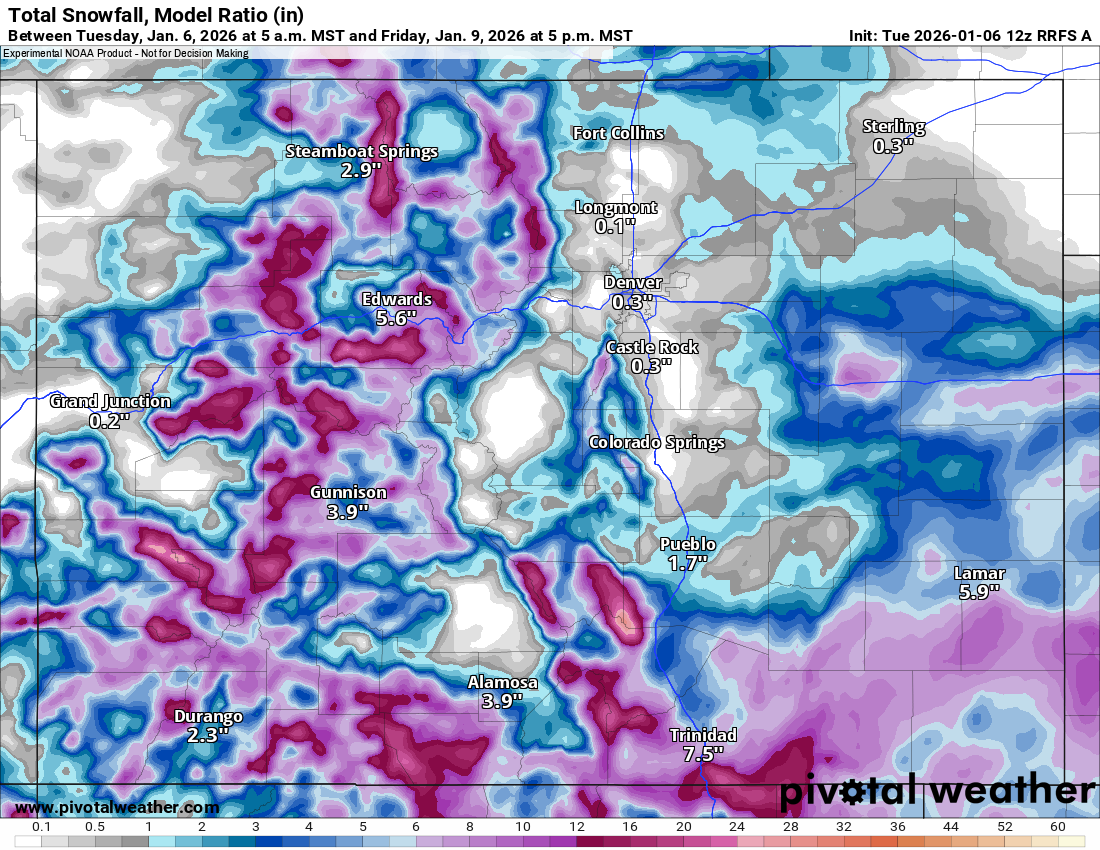
…to this…
…in just 24 hours. That’s more or less a best-case scenario for the foothills which badly need some moisture. Of course, the latest runs have oscillated back to a more mediocre (realistic?) solution as these higher-end scenarios remain elusive due to a dependence on timings and low tracks being just right.
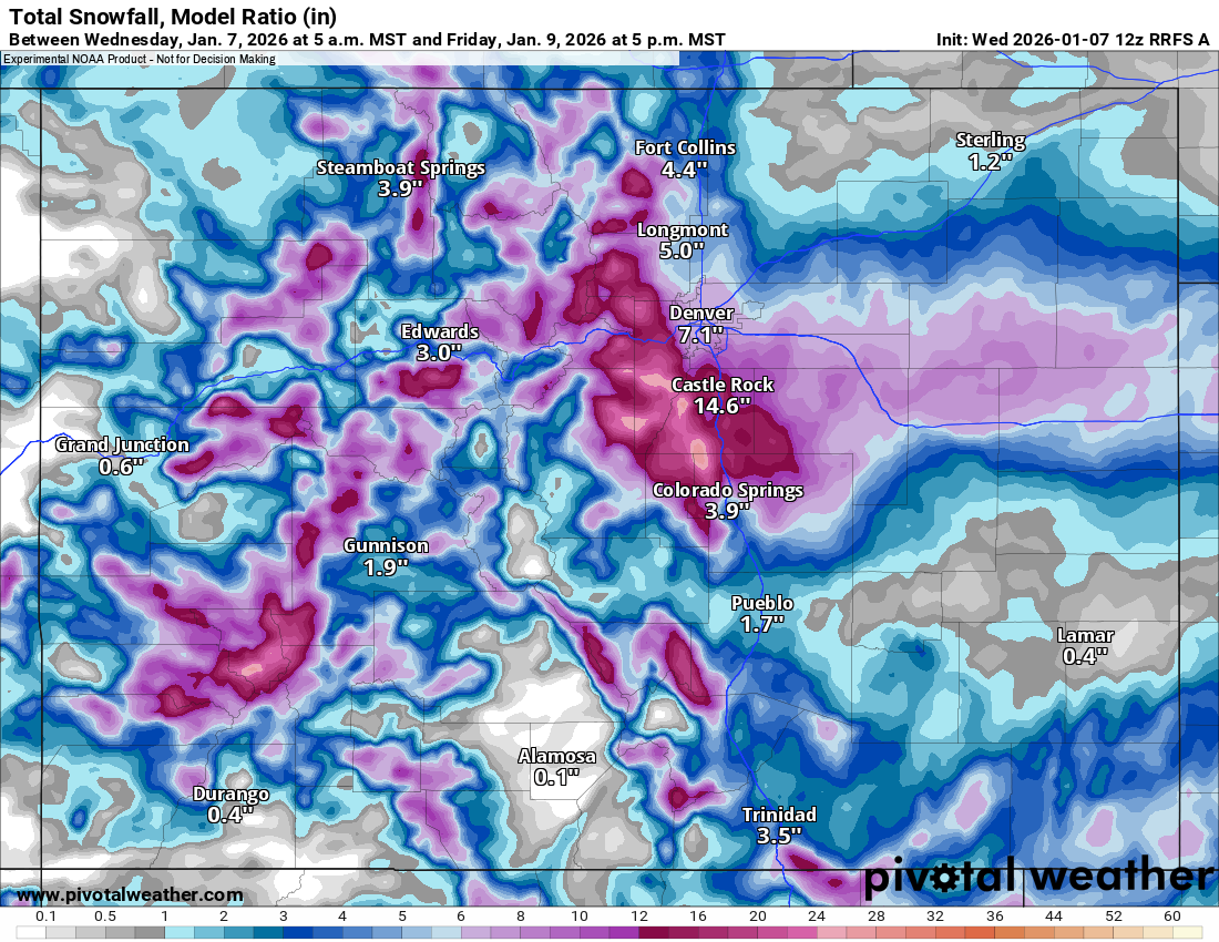
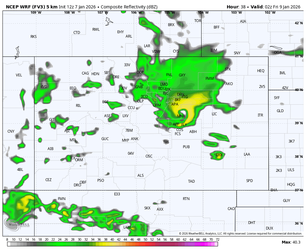
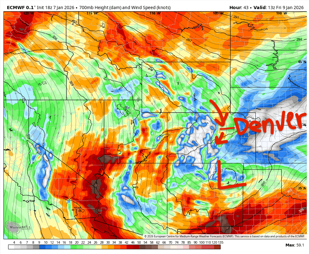
But it is amusing how the FV3-core CAMs have been consistently sniffing out a very exciting feature that is dependent on the exact track of the initial low, then the rotation of the parent trough. If everything lines up, you get some powerful convergence over the I-25 corridor, enough to spin up a transient surface low. It’s evident on the gangbusters 12Z run from today:
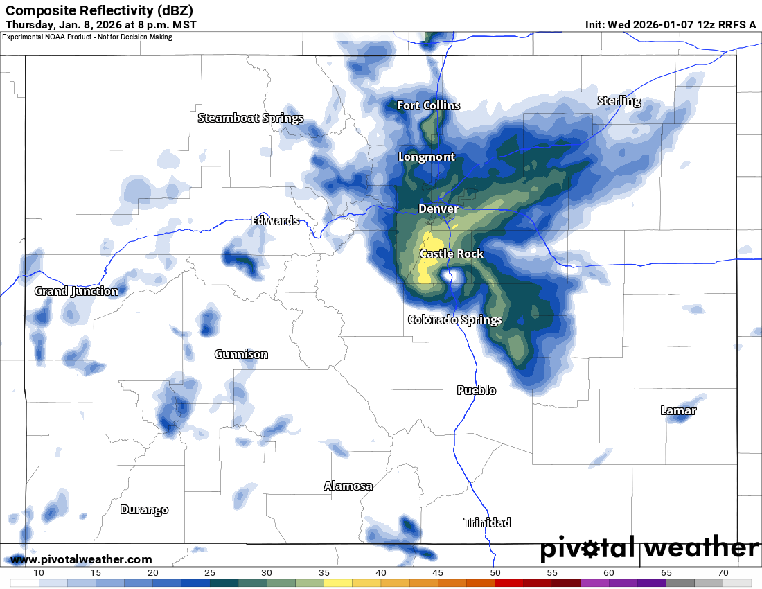
Just south of Castle Rock, if you weren’t sure. In the far less exciting 18Z run from today, it ends up a bit further southeast, with a shallower and shorter-lived upslope bringing lighter snow to the Denver metro area.
And here’s the Hires-W FV3 WRF, with a similar feature, and similar impacts:
Even some of the global models are resolving it. For instance, the latest GFS (which also has an FV3 core) bullseyes the south metro area:
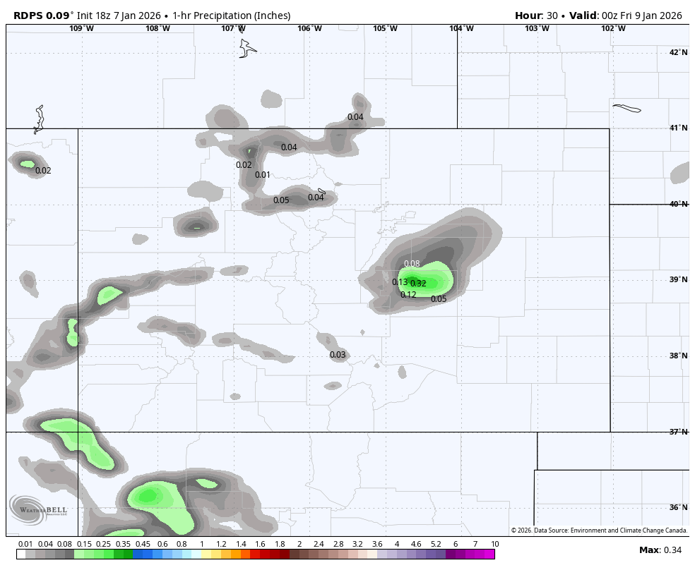
The trusty RDPS is resolving it as well, though over Colorado Springs:
As a kicker, the NBM blended reflectivity product, which doesn’t use the RRFS, is managing to resolve that feature as well, meaning there has been some consistency in CAM ensembles:
I don’t exactly have a point here besides there’s some significant upside potential that could catch some folks off guard on Thursday evening.
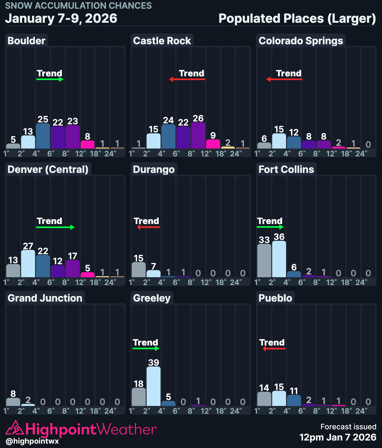
Let’s ignore that for now and talk about the more likely scenario that brings 2-4” to the Denver metro area and 4-10” for the foothills / Palmer Divide.
First, the initial low juices up the atmosphere over the high plains on Thursday morning.
This low will undergo lee cyclogenesis and there is a lot of uncertainty about how that will impact the Front Range. We’ve at least largely ruled out it tracking in such a way that induces a snow-eating downslope for the I-25 corridor. But still, too weak and too far north means that there won’t be much of an upslope on Thursday morning, which will short some spots of a few inches of snow. On the other hand, the potential for a deformation zone or a more favorable track is leading some models to resolve some healthy snowfall rates in the AM.
I wouldn’t count on it, but I would expect at least some snow showers across the Front Range tomorrow morning.
Probably the best chance for snow for the Front Range comes during the day on Thursday, due to the aforementioned convergence as the initial low exits, causing northerly flow to meet southerly flow from the encroaching trough.
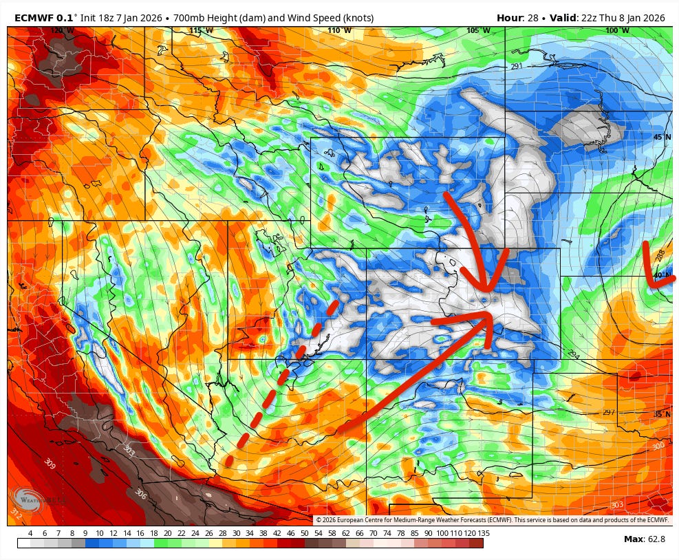
The initial low is at the very right of the image. This is when we could see those potentially high end scenarios, but at the very least, a short burst of heavier snow should push north to south down the Front Range on Thursday PM.
On Friday morning, the main trough undergoes lee cyclogenesis and gets another round of snow going. This will likely be much better for Pueblo / the Sangres than further north, as the winds may have very little of an easterly component over the northern I-25 corridor, limiting snow potential to the southern suburbs / Palmer Divide.
To summarize, there are three primary phases/mechanisms for snow to fall in the Front Range. The baseline expectation is that a half-hearted combination of some of these is a lock for 2-4” along I-25, and that there’s significant high-end potential that remains unforecastable with any degree of accuracy.
Much like the Front Range forecast, the forecast for Colorado’s high country is fairly complex with some high-end potential in spots.
We’ll likely get started (actually, we’ve already started) with some jet-induced banding and a westerly to southwesterly upslope:
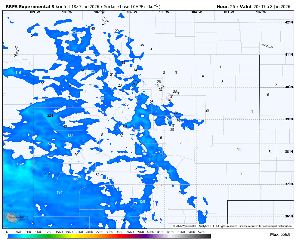
On Thursday, flow turns increasingly northerly as the trough axis approaches. Colder, less moist air is advected into the mountains. There’s also a surprising amount of CAPE (convection potential as well):
This leads to the potential for thundersnow, and for the best snowfall rates to be sort of a free-for-all as heavy snow organizes into cells and ignores orographics.
Later on Thursday is when the trough undergoes lee cyclogenesis. We’ll be looking for a convergence boundary similar to what we discussed for the Front Range as southerly/easterly winds meet northerly/westerly winds. Right now, models heavily favor that occurring along a boundary that connects the western San Juans, West Elks, Elks, northern Sawatch, Gore Range, and IPW.
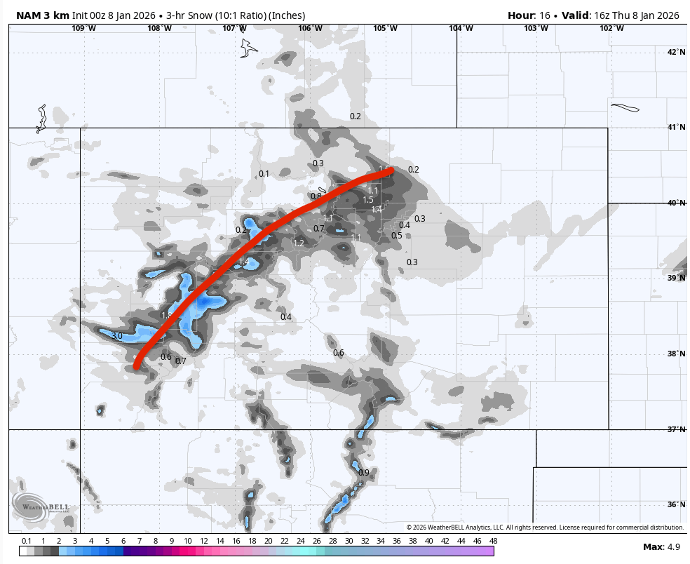
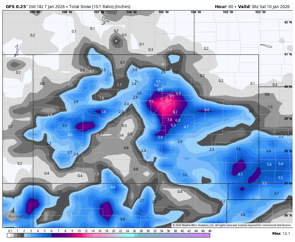
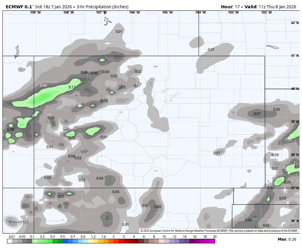
This boundary is plainly obvious on snow total maps:
Post-cyclogenesis (~12am Friday), flow turns very northerly, generally NNW to due north. There is then only a limited window of 6-12 hours for the coldest upslope snowfall to occur before drier air shuts off snow production.
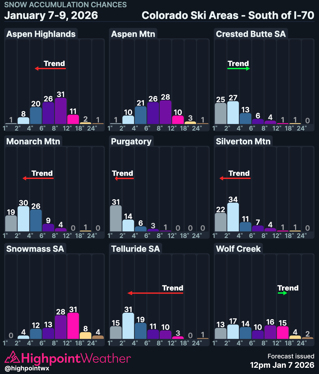
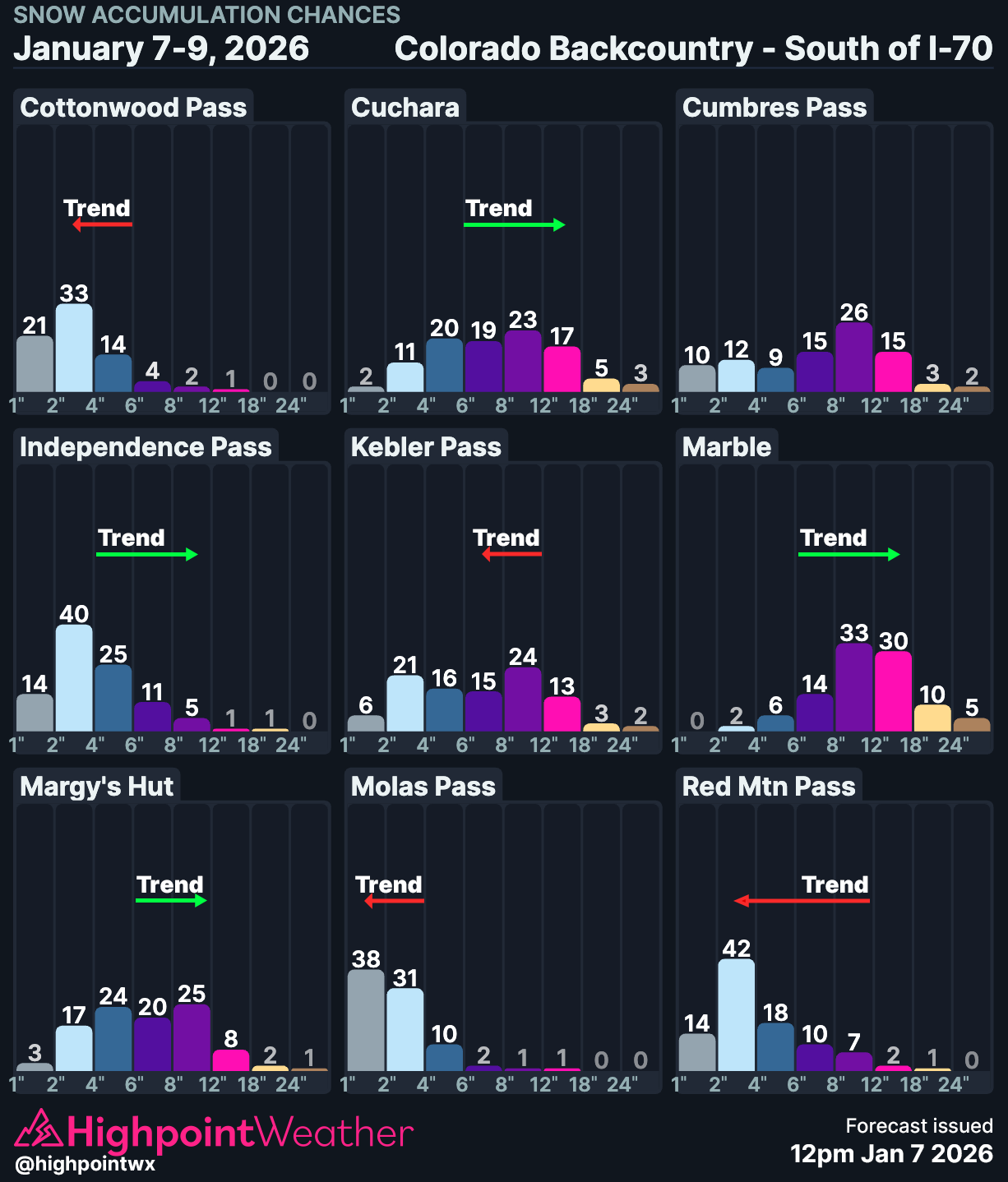
Despite the plethora of wind directions, plus non-orographic components, there are some obvious losers given all of the above ingredients. A notable candidate for bust potential is the Tenmile Range, particularly Breck and Copper. While they may pick up some scraps from the convergence boundary on Thursday, in addition to getting lucky with some convective cells and banding, it’s hard to imagine moisture managing to tuck into that area effectively given the predominant winds in the region.
With the convergence boundary to the north, SSW winds will have dumped quite a lot of moisture on the San Juans, Elks, and Sawatch by the time they make it there. Later on in the storm, the winds may be just northerly enough for that area to be properly in the shadow of the Gores. Here’s an almost unreadable diagram that I am far from proud of:
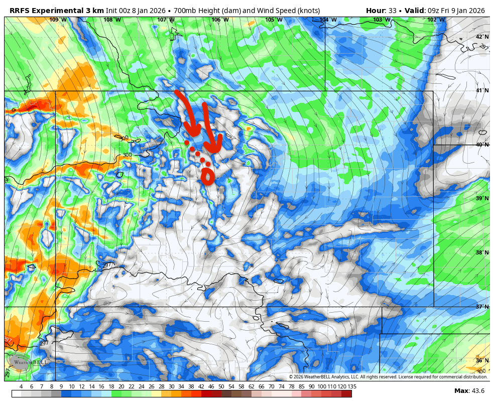
The dotted lines being the Gores, the circled area being Breck, the arrows being the wind directions. Usually with northwest flow you can get the winds to funnel nicely up Vail Pass and bring snow to that mountain range but there may be too much of a northerly component for that to happen.
Parts of the Sawatch and the central San Juans are also likely to struggle for similar reasons. The Park Range I’m not sure about…it seems to be quite sensitive to a more northerly wind, with just a few degrees separating “nice event” and “rude DMs.” Pretty sure there’s an angle where the winds funnel up between the Elk Heads and Park Range just right…but otherwise a much more westerly wind aspect is preferred. Somebody buy me a Steamboat pass and I can go do more research :)
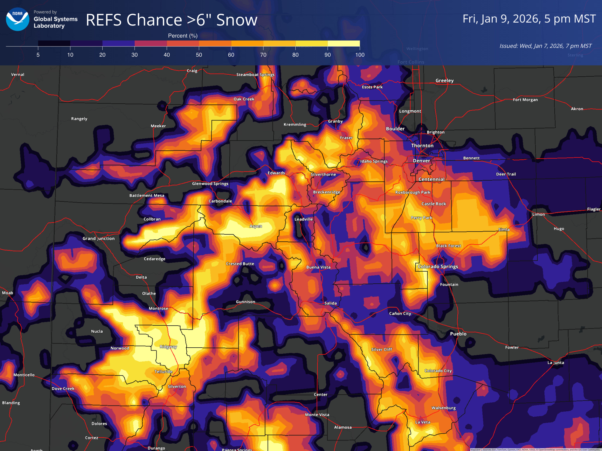
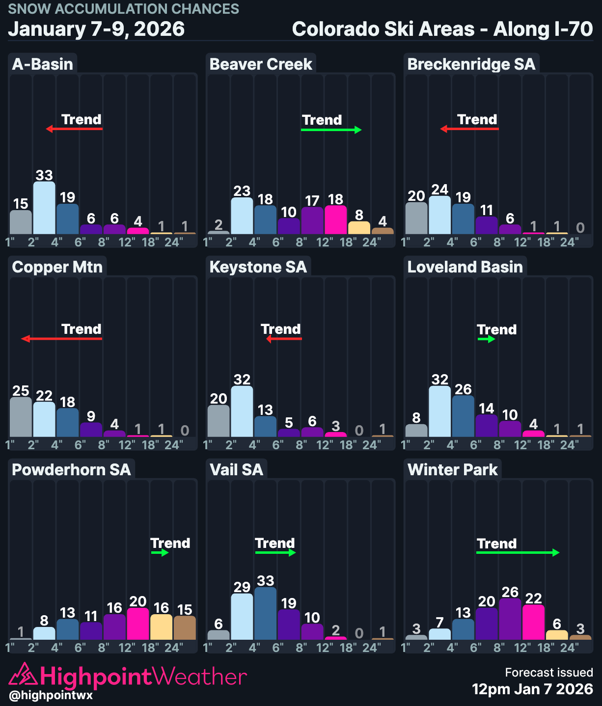
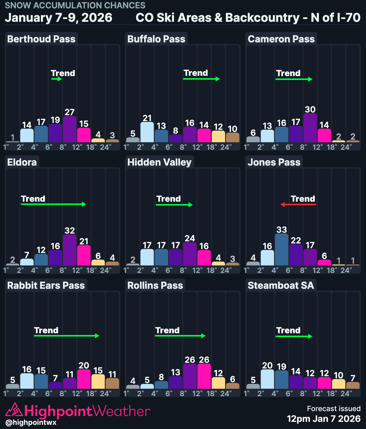
Conversely, the Vasquez Peak Wilderness area / Williams Fork / Berthoud Pass / Winter Park / JPW / IPW could do very well with this setup and it’s not surprising to see them topping the probability charts. Speaking of those…
As for snow quality? Rain/snow levels shouldn’t be too much of an issue with this storm (weird having to type that out in January), initially around 6,000-6,500ft but dropping below 5,000ft on Thursday evening. SLRs will also not be initially too bad, somewhere around 15:1, increasing to 20:1 by the end of the storm.
I’ll leave it at that without going too in-depth into timings and exact totals. Hopefully this provides some context for the snowfall forecasts and timings you’re seeing from other sources and weather apps.